Imagining Land Use Reforms with AI (view)
Human
I love cities. My work explores the relationship between humans and humans, humans and their environments across many dimensions: ecologies, economies, laws, and aesthetics. A pluralist, I’m drawn to both the sciences and arts that shape how we live together in space.
I currently focus on regulations: the making, interpretation, and advocacy. Two ideas guide me: (1) helping global governments make cities better for people, and (2) helping organizations or individuals navigate actions within the public interest.
I address pressing urban issues: land use, transportation, health, the environment, energy, and innovation. In research, I use causal data science and emerging technologies. In advocacy, I leverage diplomatic, design, and Socratic methods to support ligitation, mediation, and education.
I am nostalgic. I use old-school communication - emails, calls, and face-to-face chats with 👁️ eye contact. I love public speaking.
All about human behavior.
PRINCIPLE
Our core value is asking meaningful questions and advancing ideas grounded in lived experience and societal insight.
METHOD
Great work bridges divides. We integrate advanced technologies and traditional methods to foster interdisciplinary collaboration.
2026- ; 2023-2024-2026

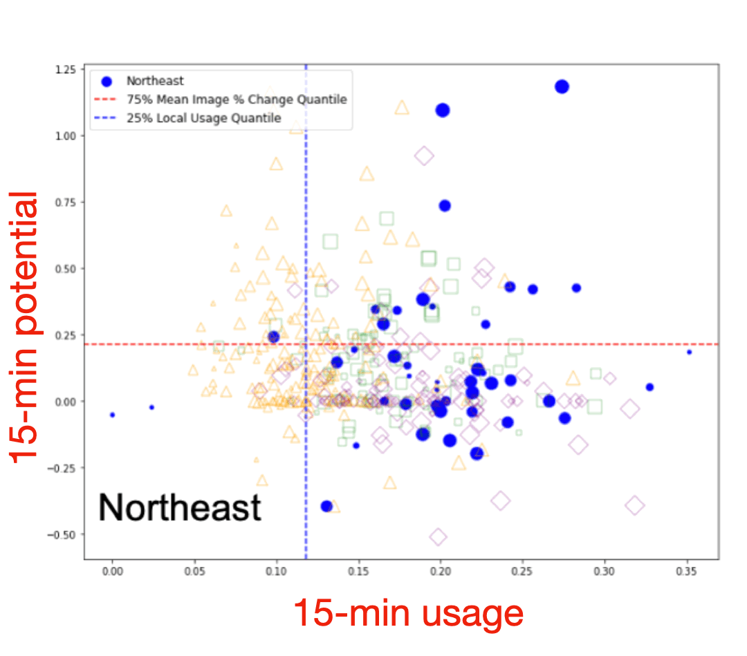
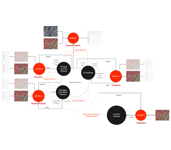
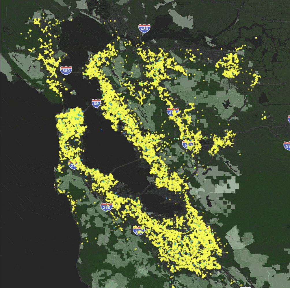
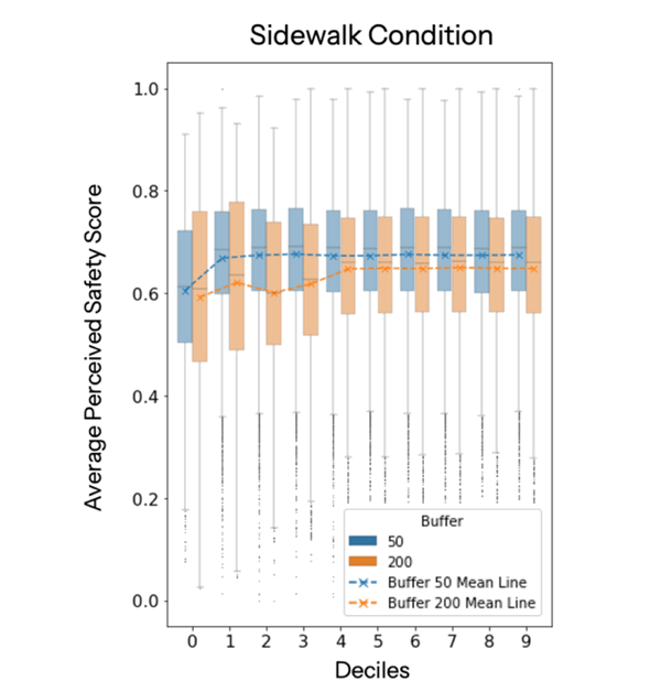
Leading urban policy research projects using causal data science and AI. My research helps ground and advocate for global and U.S. national level policy reforms that advance health, sustainability, and the economy. I work with a diverse range of research units within the UC system: ITS (LA), IoES (LA), IURD (Berkeley), etc. Teaching activities include both theoretical and methodological classes.
2026- ; 2024-2026

Leading urban livability research projects using large-scale data and AI. My research advances global planning paradigm shifts to make cities better for people. I manage end-to-end research workflows, collaborate with multiple PIs, and deliver weekly briefings to industry and municipal partners. I was a speaker at the 2024 MIT Senseable Forum on Future Cities, with over 100 participants from five continents.
2026-; 2021-2023
Sample Courses:
A - Architecture & Urbanism Studio
A - Architecture & Urbanism History
A+ - Culture of Practice
A+ - Scalable Spatial Analytics
A+ - Analytic and Research Methods for Planners: GIS
A - Back-End Web Architecture
A - Locative Media
A - Land and Housing Market Economics
A - Urbanization in Developing Countries
A- - Thesis Seminar & Studio
A- - Urban Informatics and Visualization
A- - Advanced Study of Energy & Environment
A- - Citizen Involvement in the City Planning Process
...
2016-2021; 2015-2016
Sample Courses:
A - Architectural Design
A - Urban Planning & Design
A - Visual Design
A - GIS & Its Application in Urban Planning
A - Urban Ecology & Environmental Planning
A - Physical Environment Analysis
A - City Policy Analysis
A - Data Analysis of Urban Planning System
A - History of Foreign Landscape
A - Architectural History
A - History of Urban Planning
A - Advanced Mathematics
A - Linear Algebra
...
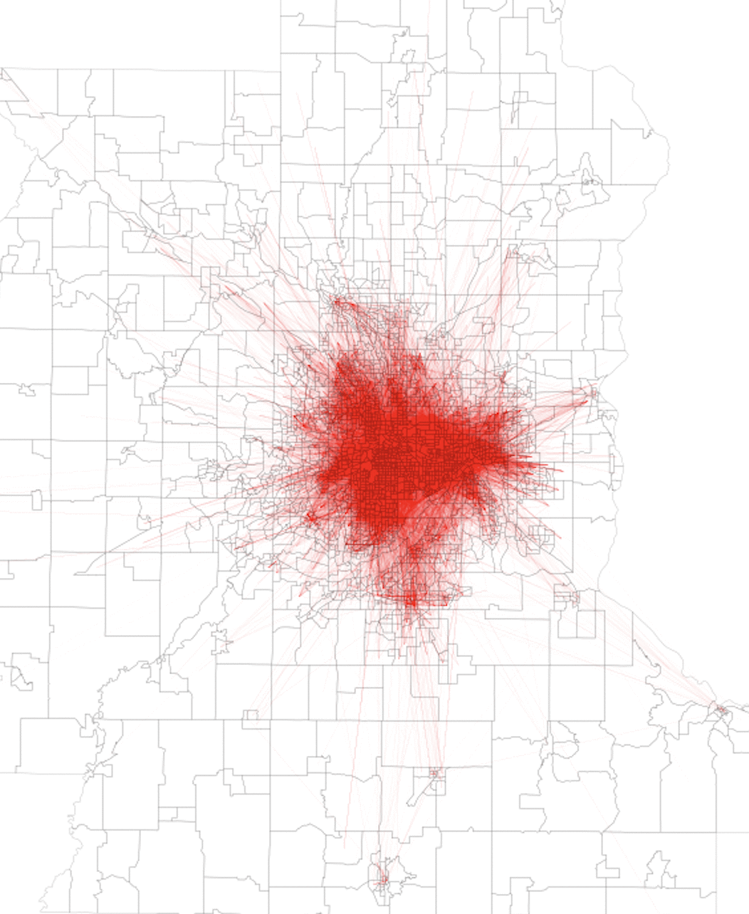
I work to make cities better for people.
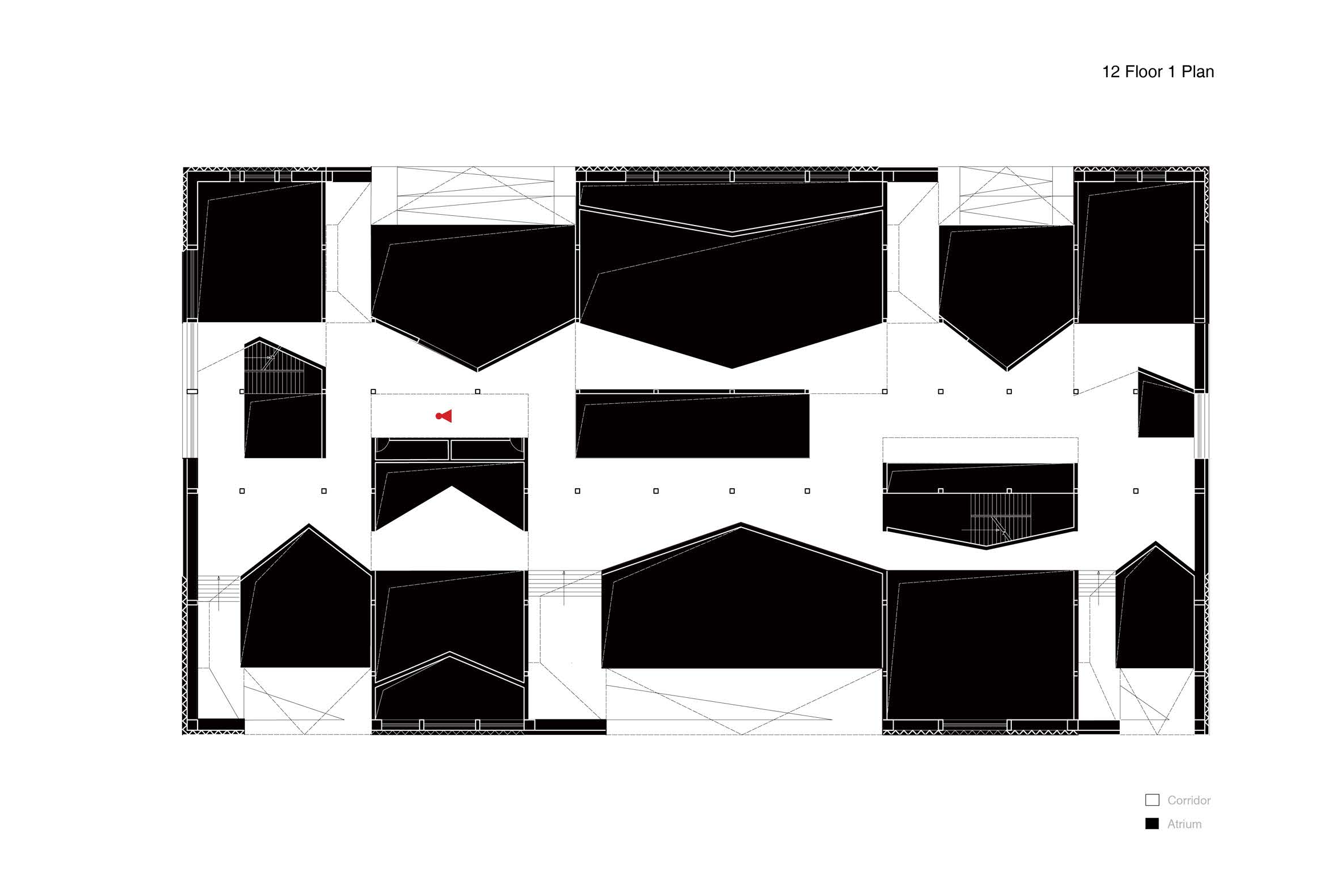
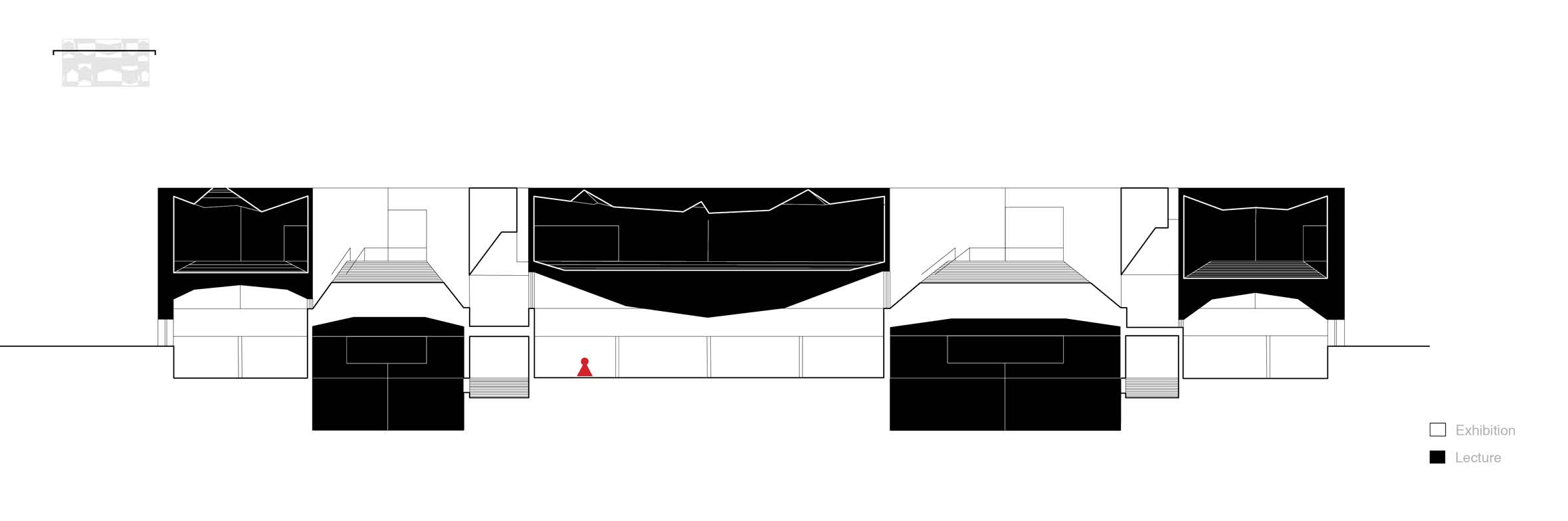
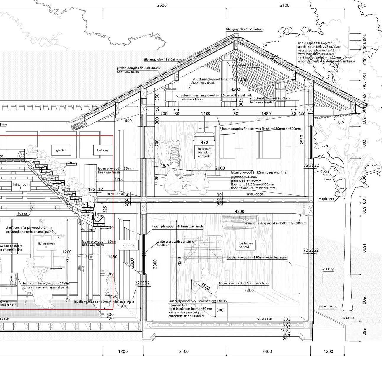
Building Design
A dynamic urban interface.
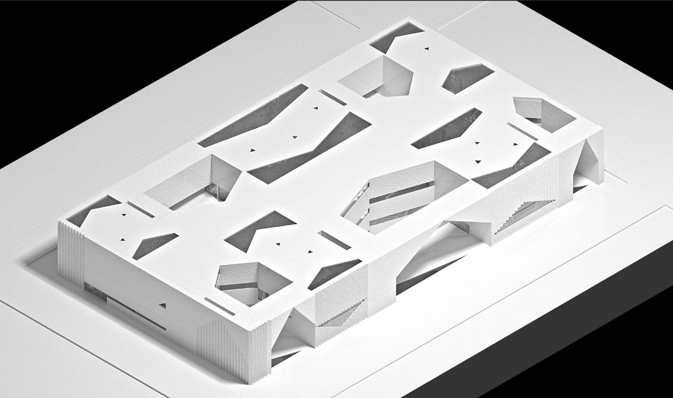
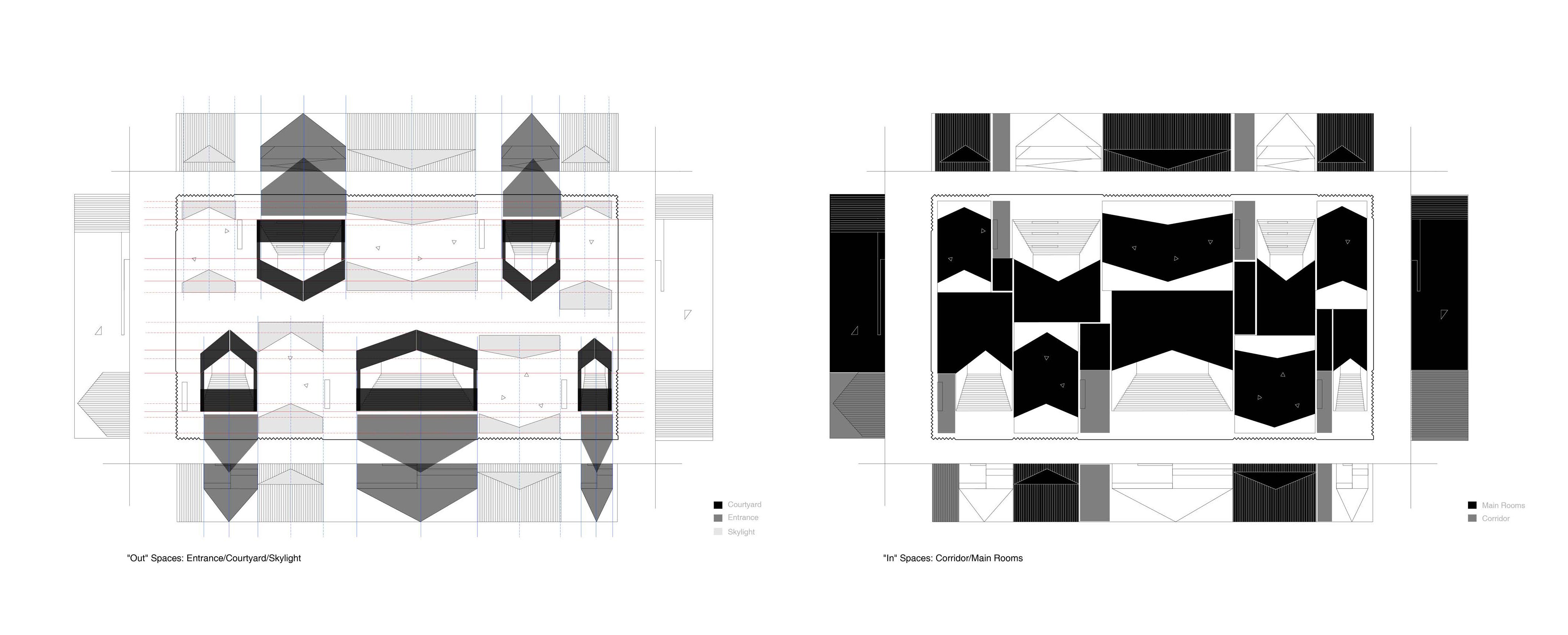
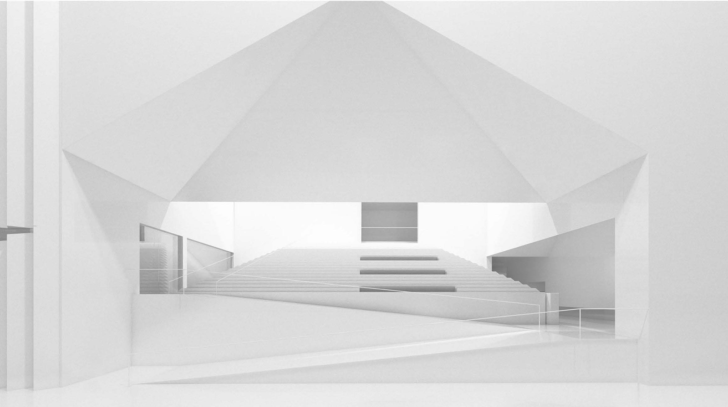
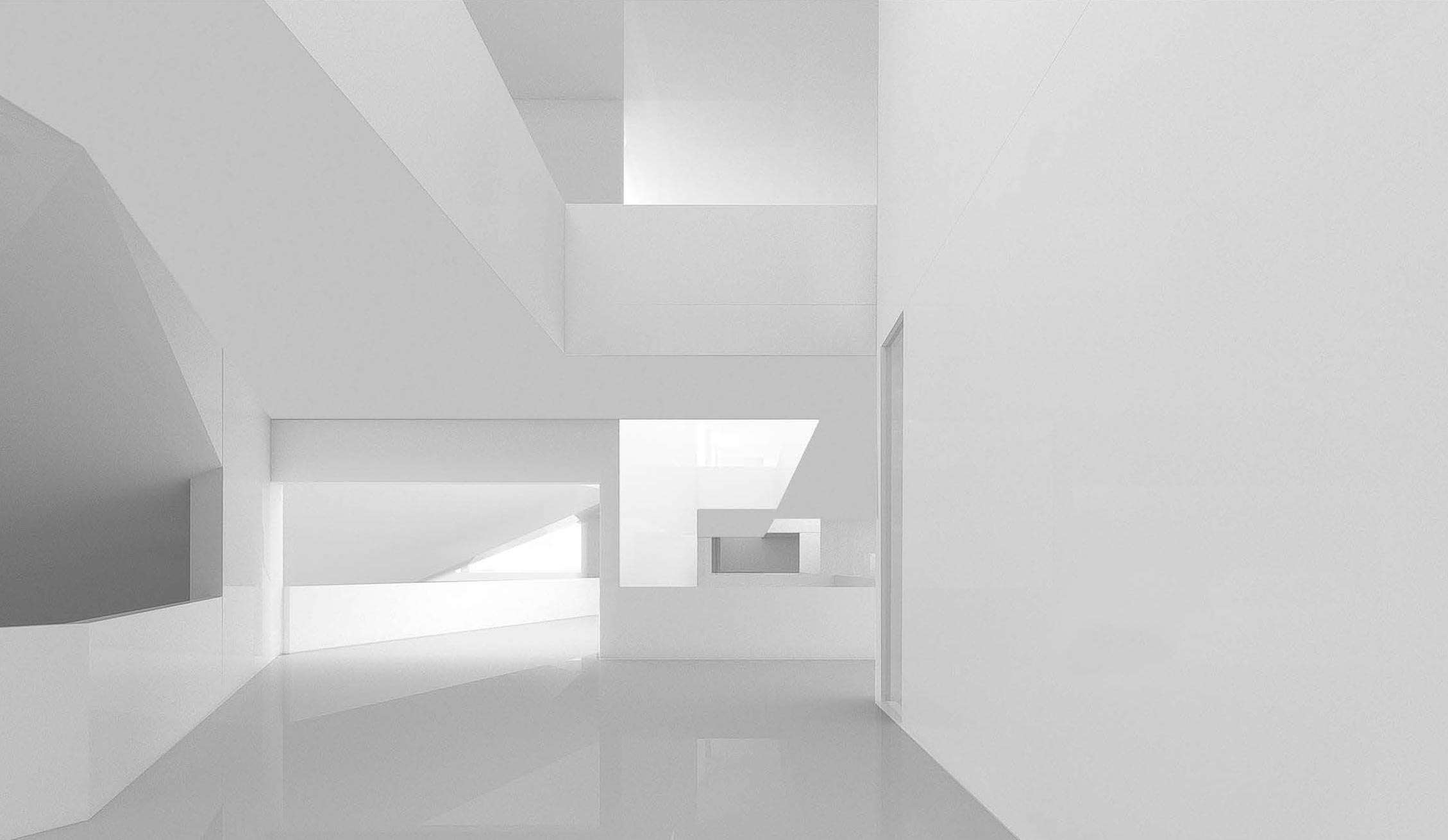
Building Design
A porous scheme that curates natural light.
Building Design
A porous scheme that curates natural light.
Building Design
A porous scheme that curates natural light.
Building Design
A porous scheme that curates natural light.
Building Design
A porous scheme that curates natural light.

Building Design
A porous scheme that curates natural light.
Building Design
A porous scheme that curates natural light.
Building Design
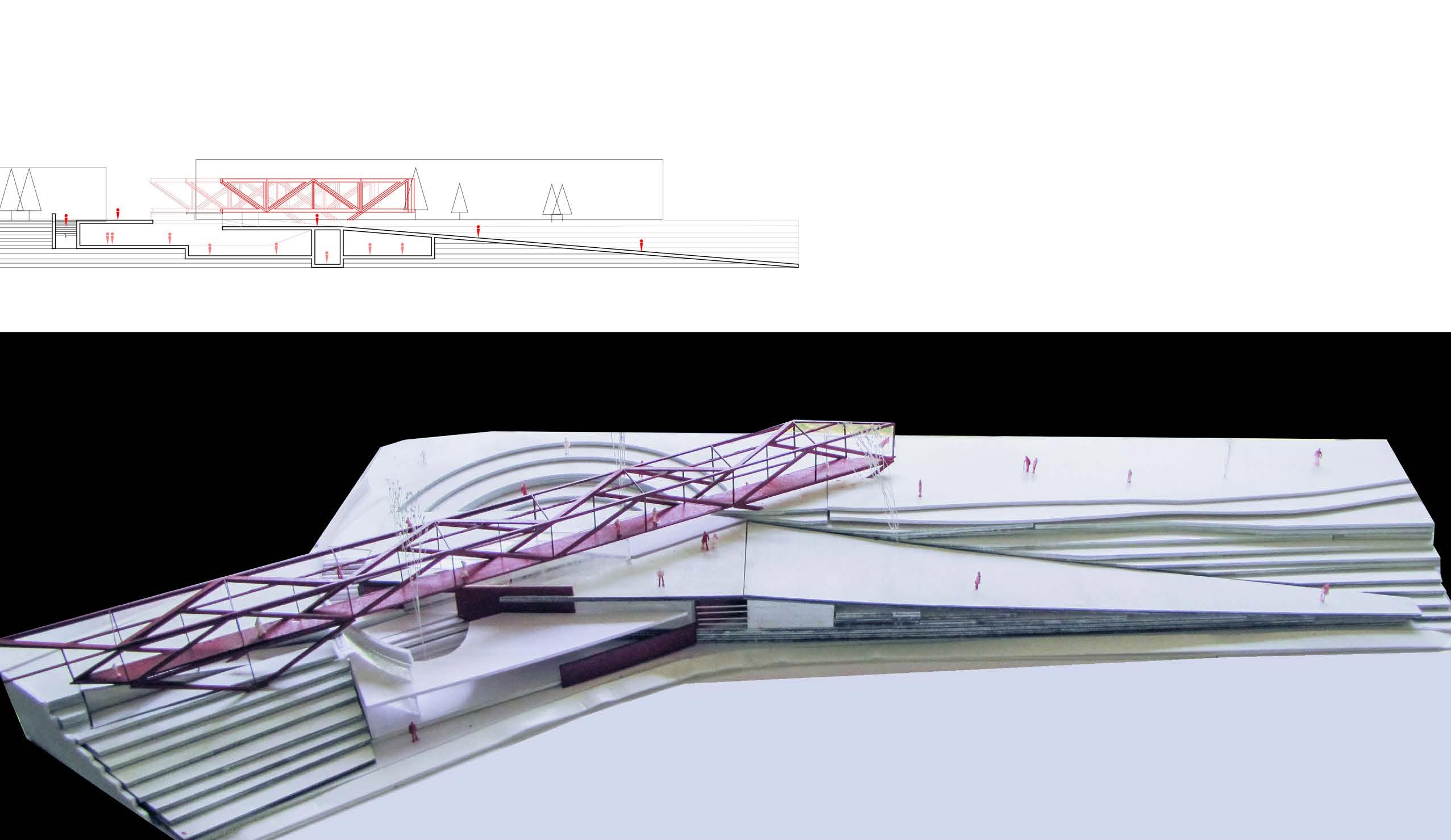
Urban areas are connected by a scenery space.
Pavilion Design
A convertible roof shapes residents' activities.
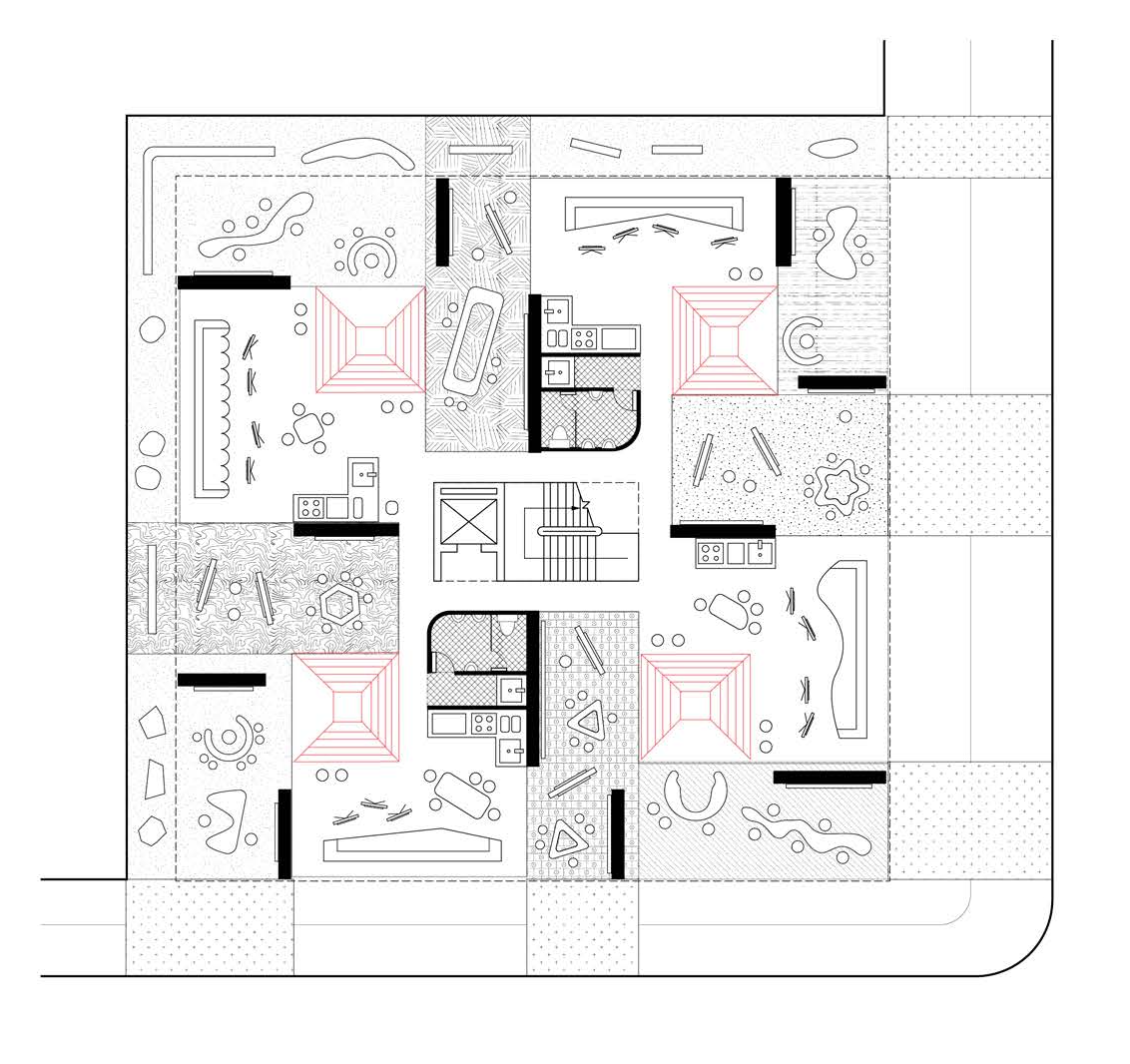
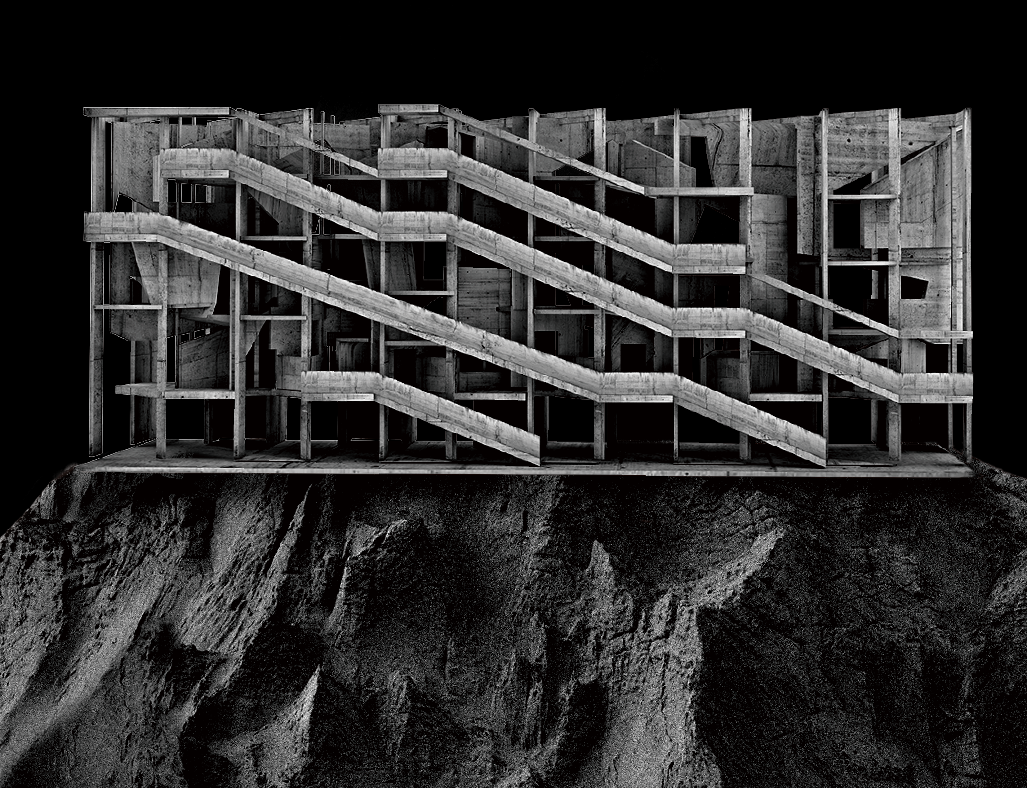
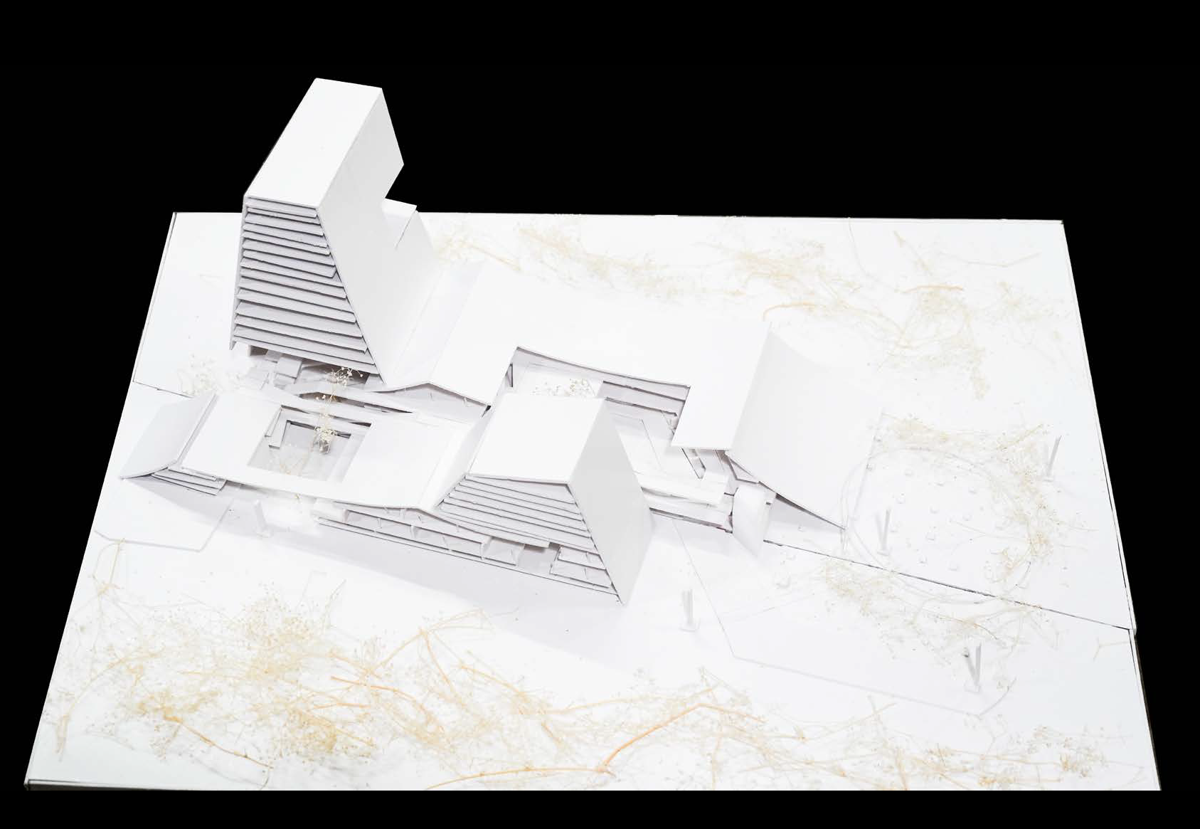
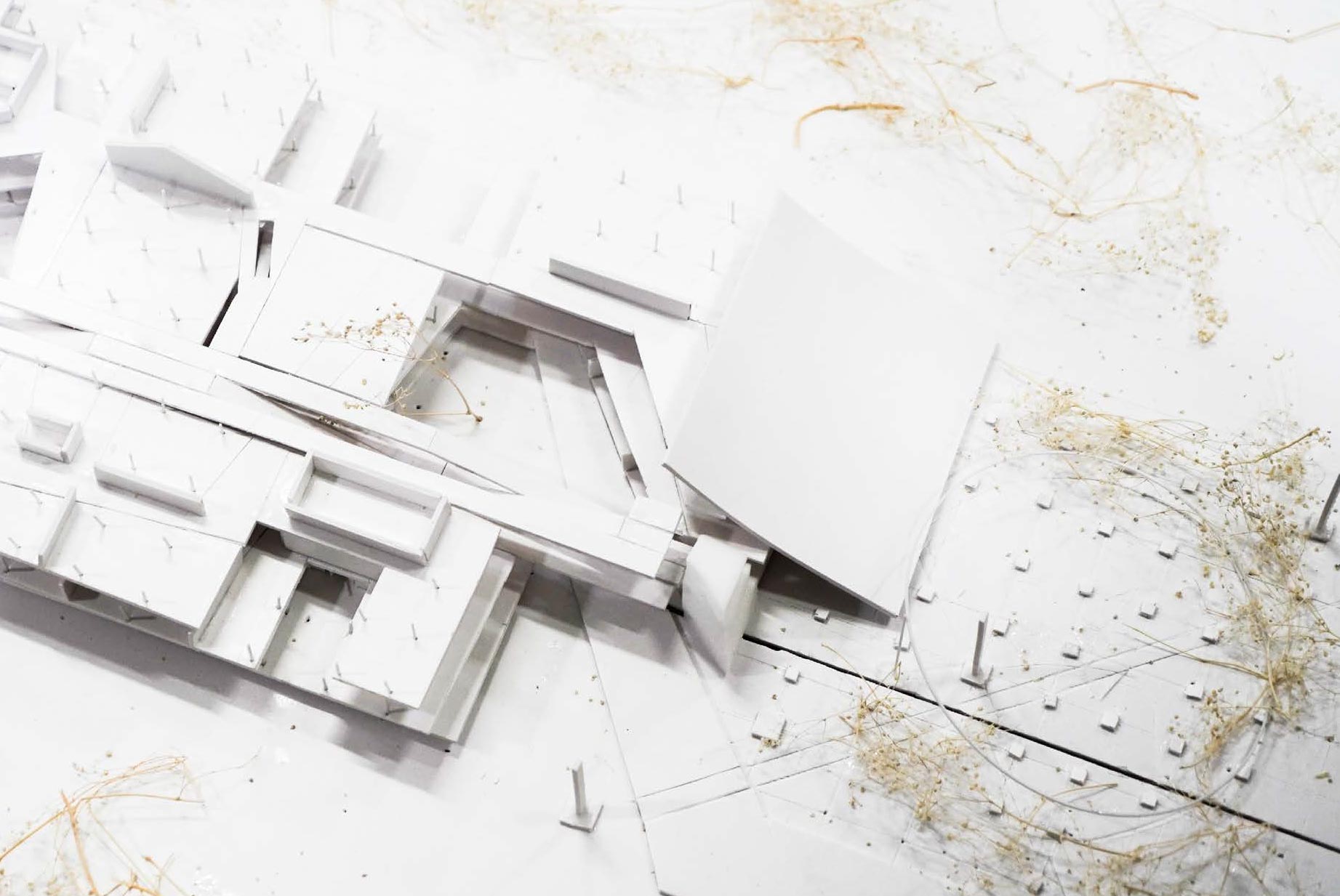
Building Design
Public space for the publics.
Building Design
Blurring the boundary between narrative and geometry.
Building Design
Blurring the boundary between narrative and geometry.
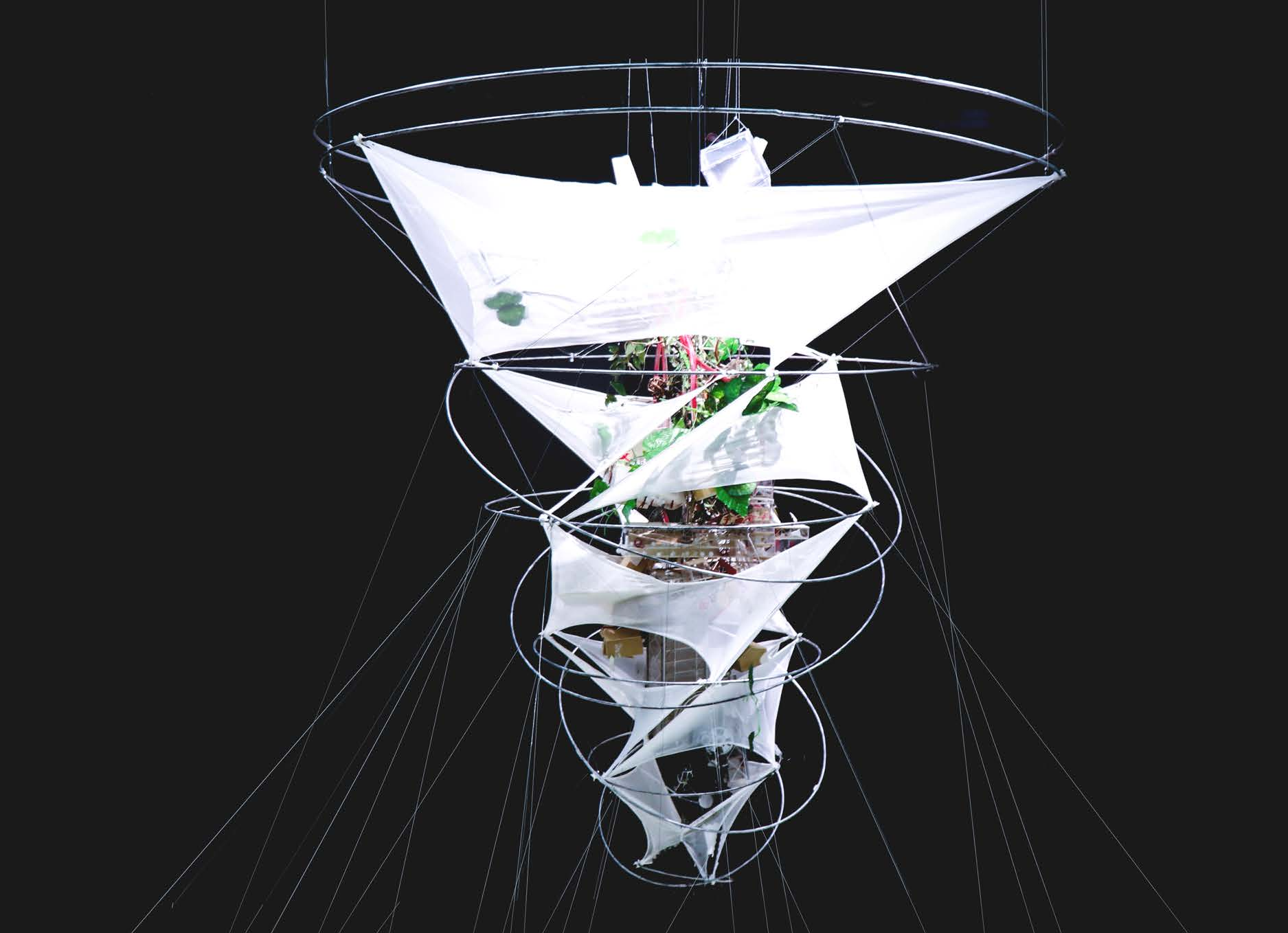
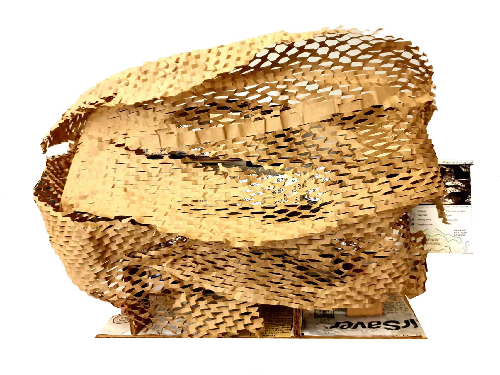
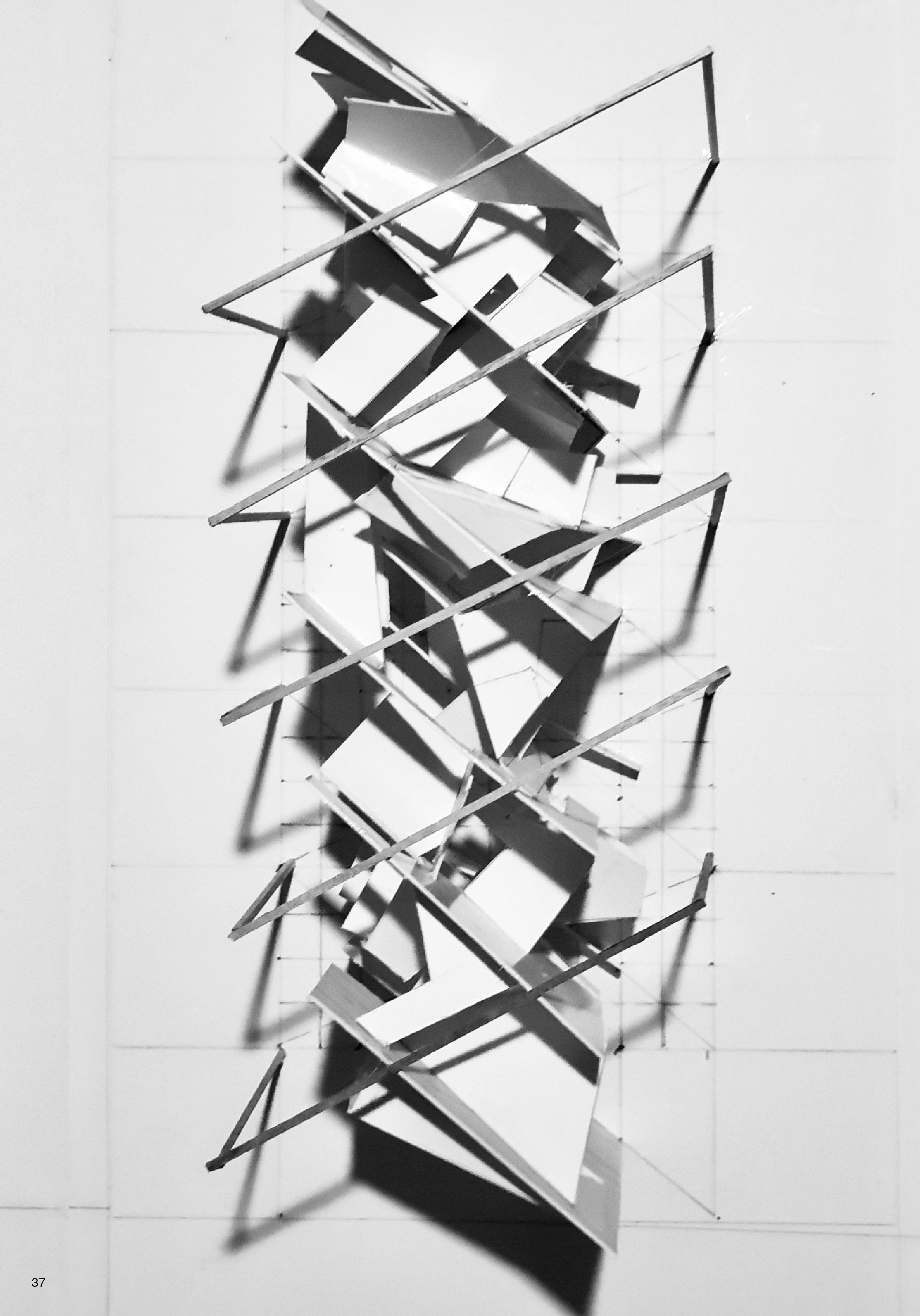
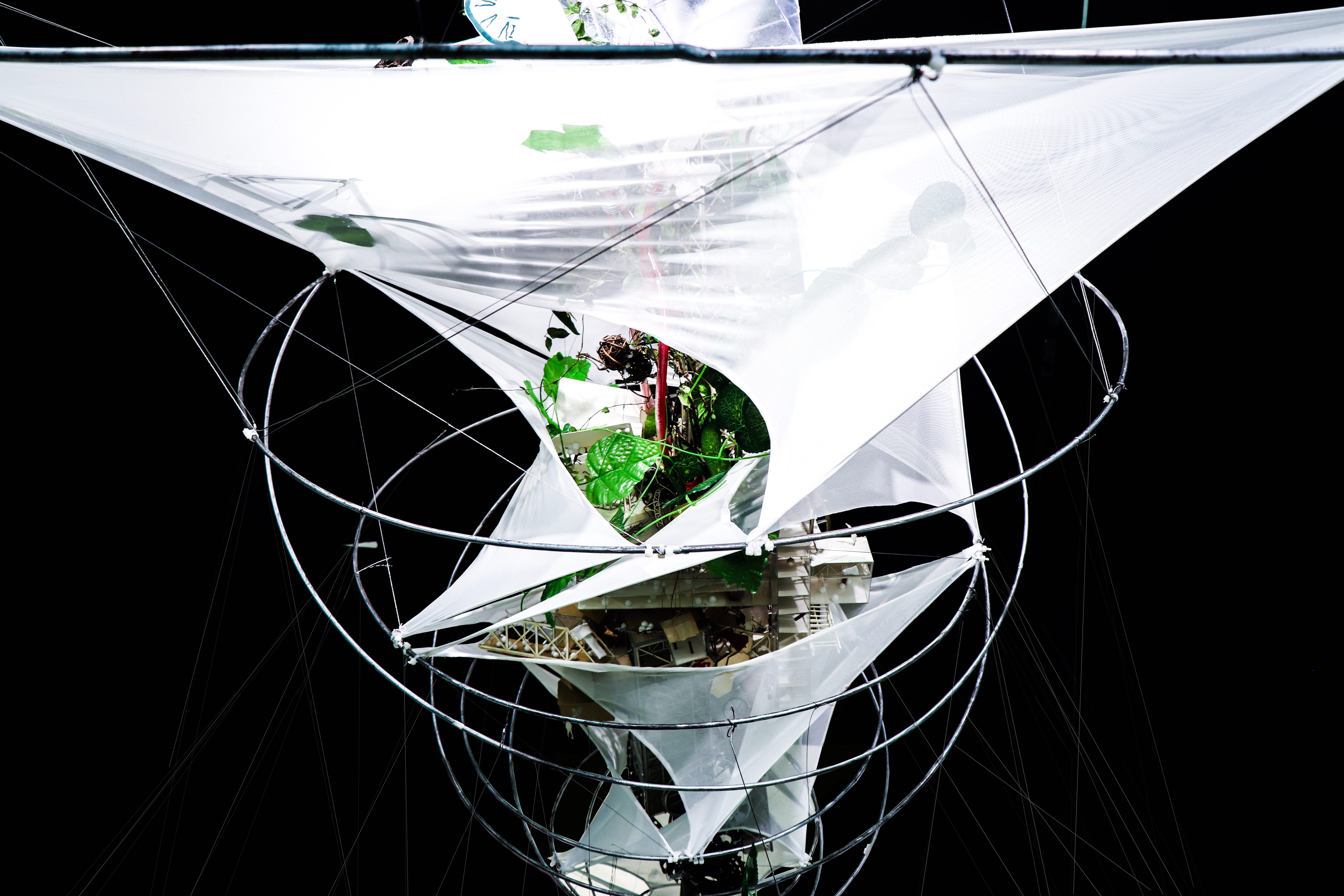
Installation Design
A home when the doom comes.
Installation Design
A home when the doom comes.
Landscape Design
A park for humans and non-humans.
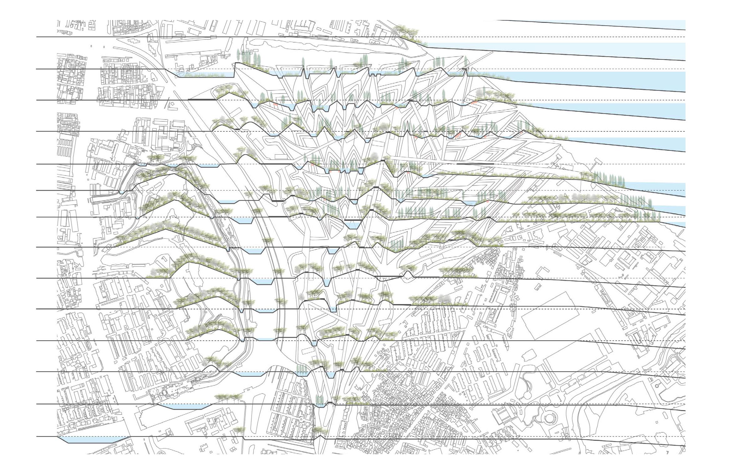
Landscape Design
A park for humans and non-humans.
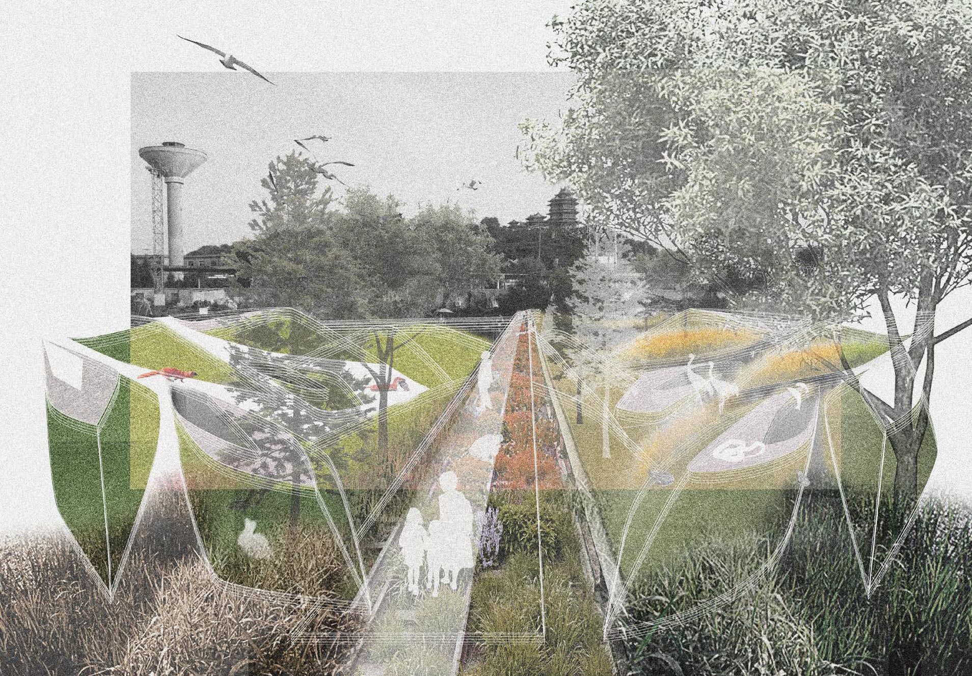
Landscape Design
A park for humans and non-humans.
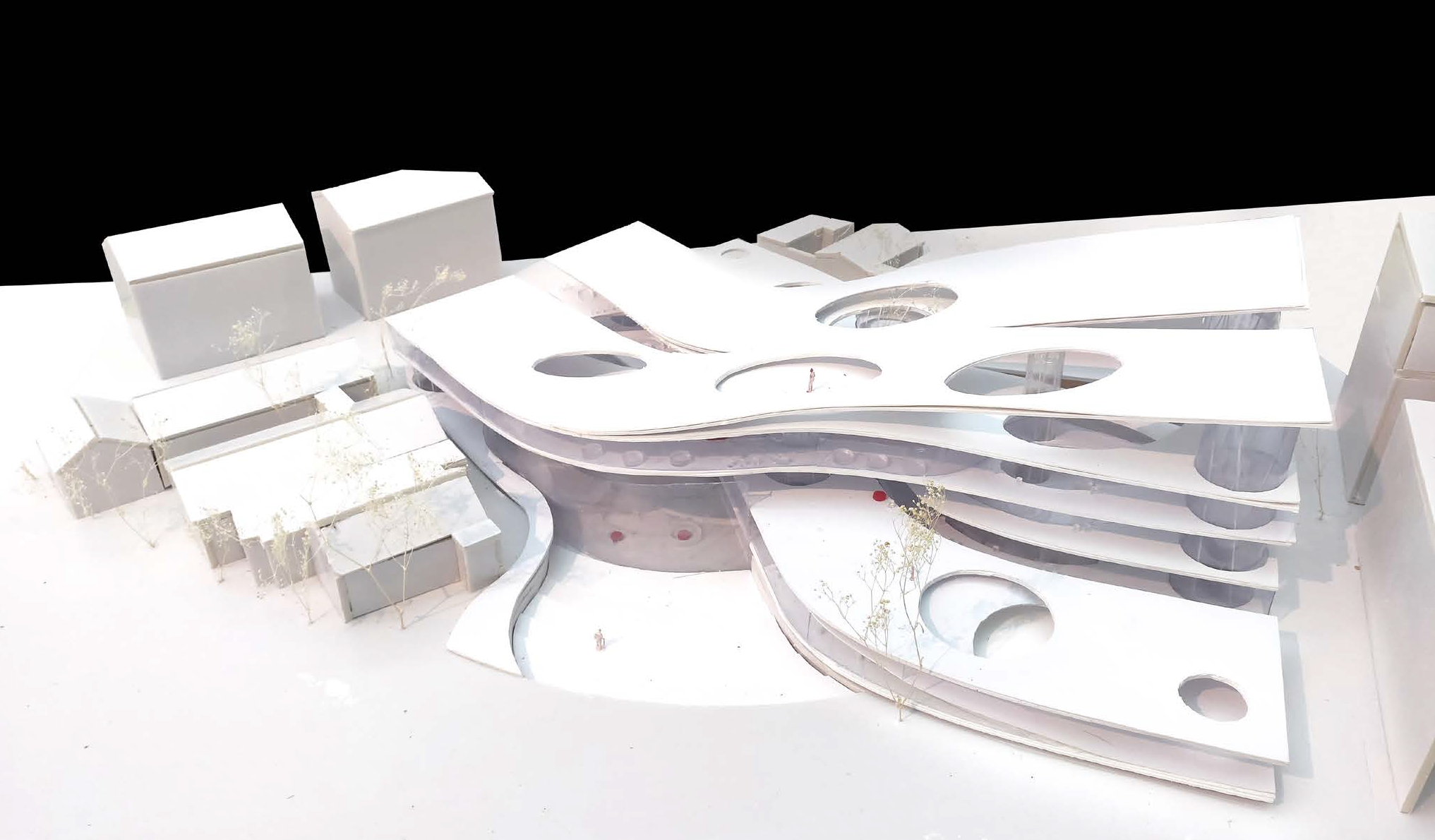
Building Design
A community center connecting urban spaces.
Building Design
An urban complex shaping landscapes.
Building Design
An urban complex shaping landscapes.
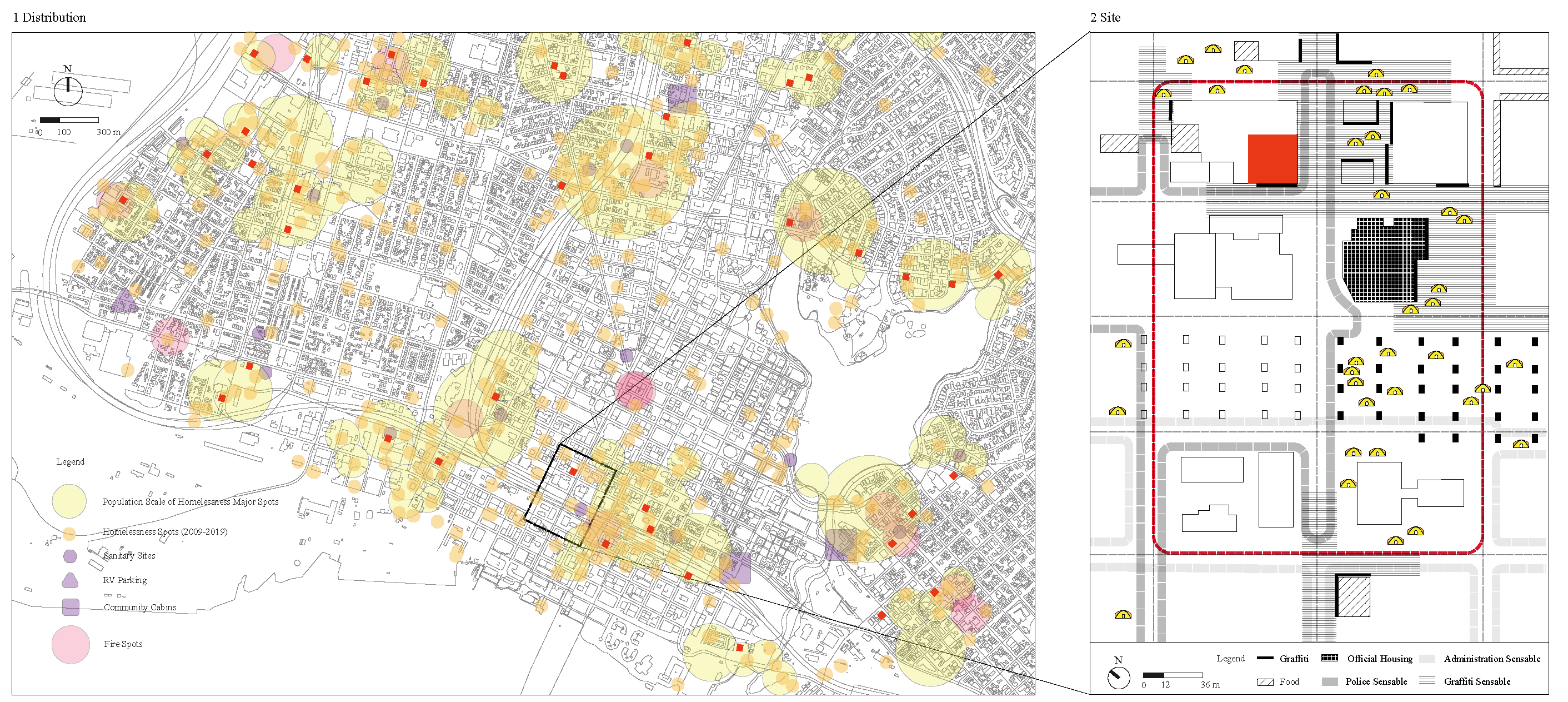
Media Design
How does the unhoused live in Oakland?
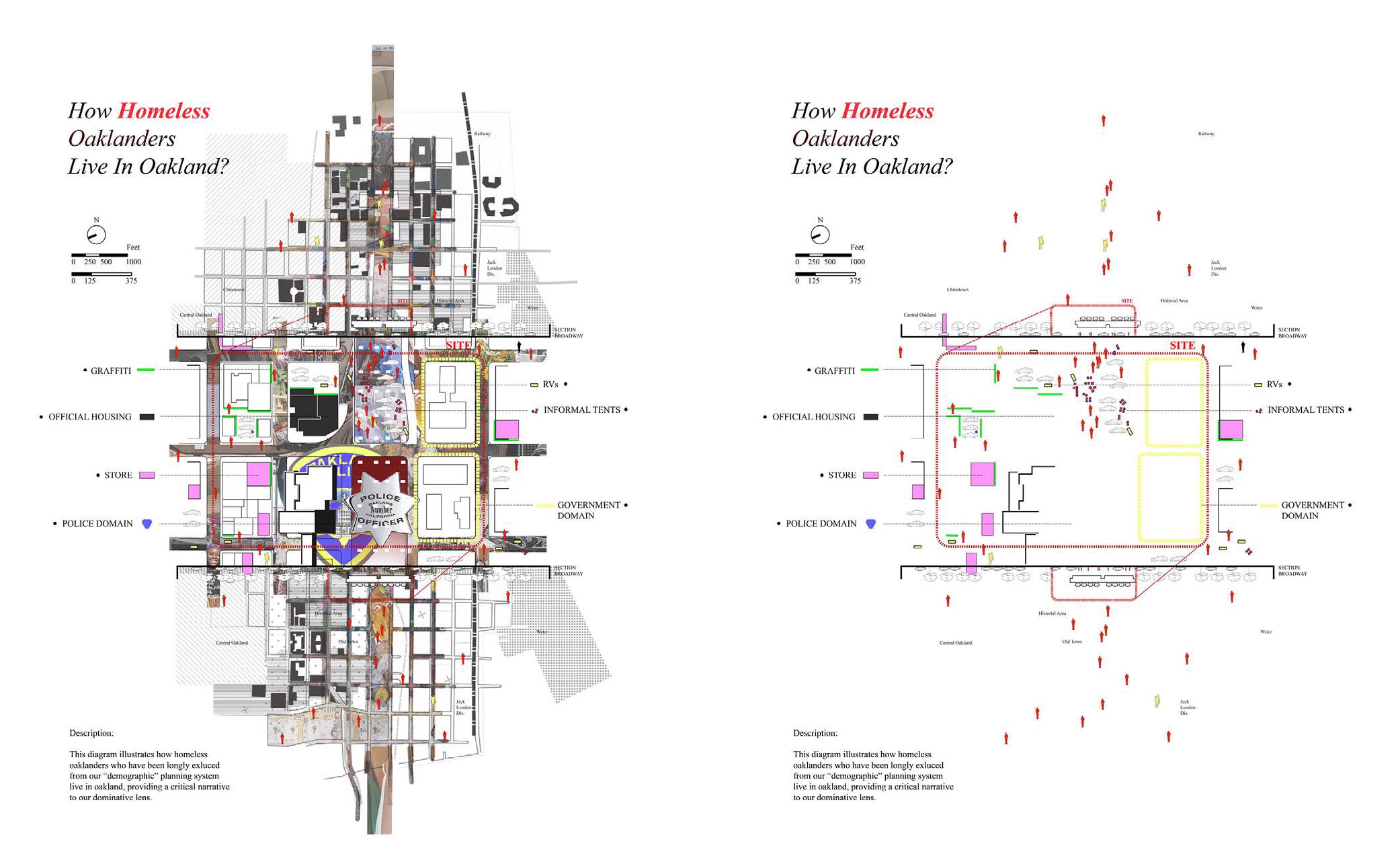
Media Design
How does the unhoused live in Oakland?
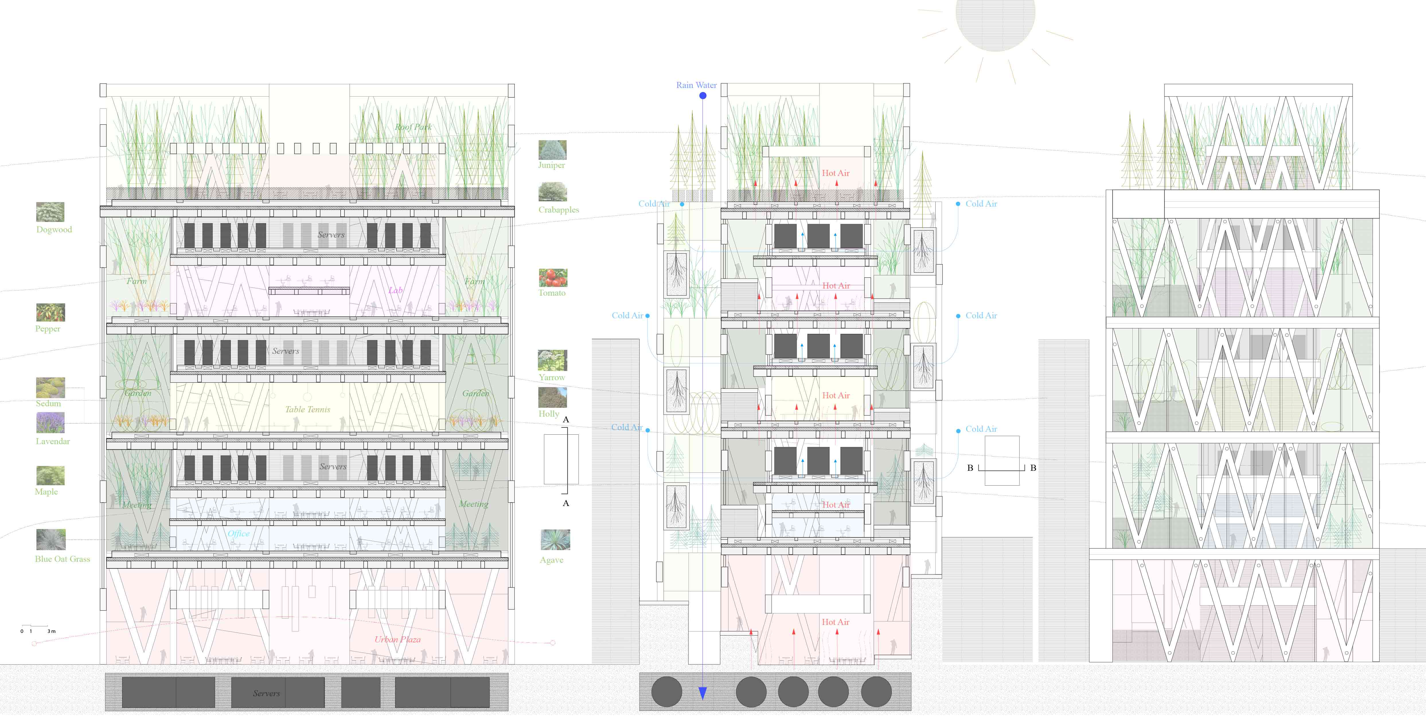
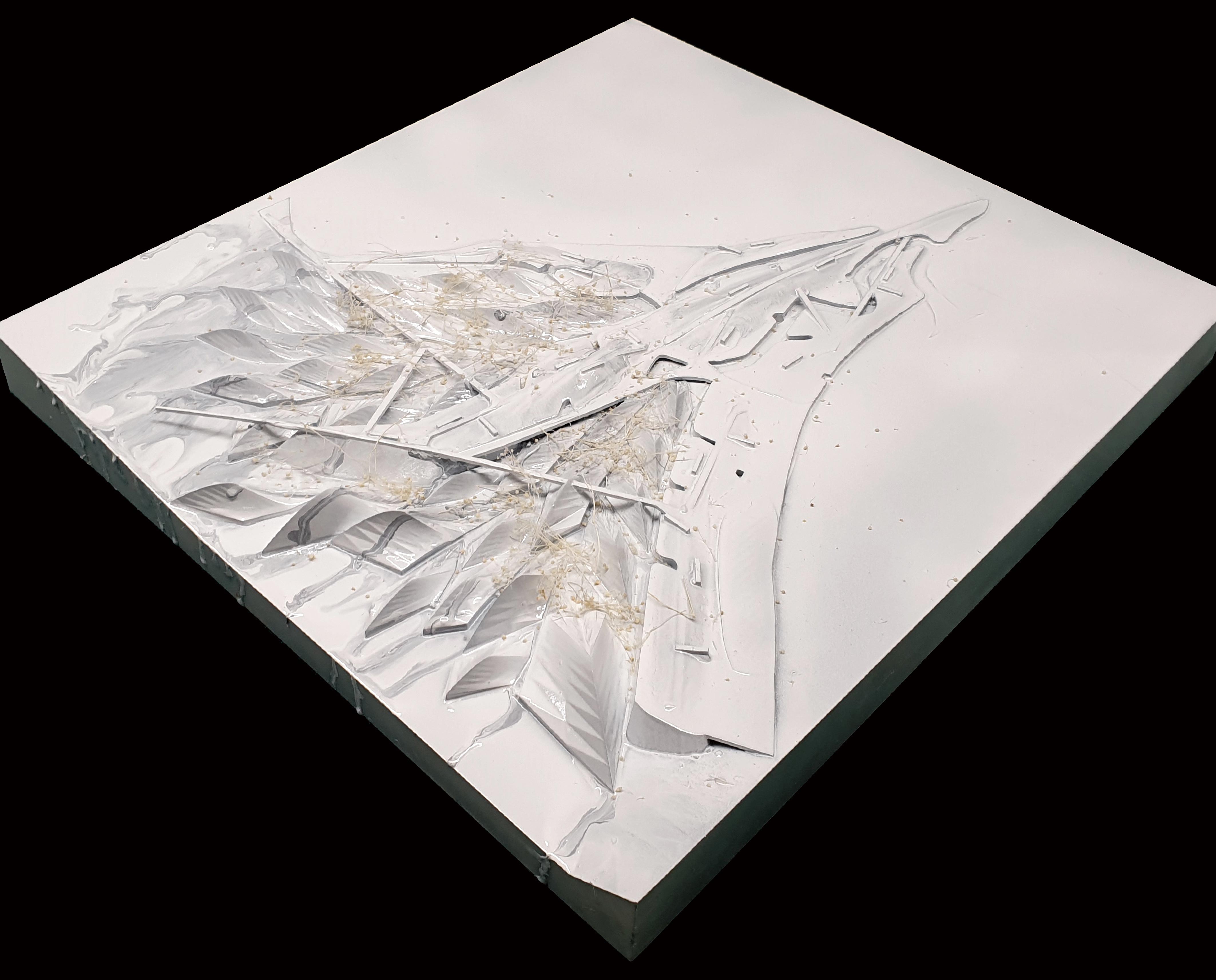
Building Design
A data center reusing waste energy.
I am still learning and evolving.
"Love Minus Zero/No Limit" (1965)
If my work moves you, let’s connect.
linkedin.com/in/charlesqcli
cityquestlabs@gmail.com
Earth
Solar System, Orion Arm
Milky Way